Srinagar, the capital of newly formed union territory Kashmir is situated in the south/central part of the valley bordering with other districts such as Pulwama, Budgam, Anantnag, and Baramulla. The entire city is located on both sides of Jhelum river which is also one of the tributaries of the mighty Indus river.

Srinagar is well known for its tourist attractions such as Dal lake, boathouses, mughal gardens from the Mughal era in India, and a stupendous national park at the edge of the city but none of those have ever attracted as many eyes and ears to this small city as the constant socio-political upheavals have. Eversince the partition in 1947, Kashmir has been reduced to a war zone between India and Pakistan’s constant scrambles to edge out each other in the disputed parts of the valley.
Recently in august this year (2019) the article (370A) providing autonomy to the people of Kashmir was scrapped by the Indian government which ensued chaos of an unparalleled magnitude only later to be snubbed by over a million armed forces only inside the Kashmir valley and especially in the capital Srinagar.

Behind the thick fog of violence, bloodshed and a perpetual atmosphere of fear in the valley lies a culture so unique and beautiful which thrives in a close symbiotic relationship with nature. The rich and vibrant culture in Kashmir has many great aspects to it such as culinary, farming, fabric, exceptional hospitality to name a few.

A high majority of the population in Srinagar is of Muslims followed by a small percentage of Hindu, Sikh and Buddhists. notably, the city has a good literacy rate and most people can at least understand and speak 2-3 languages (commonly Urdu, Hindi and Kashmiri – occasionally English). Not so surprisingly a big chunk of the working class is employed in hospitality and tourism-related work but with an all-time low in tourism in Kashmir due to unstable conditions has left much of these people wondering about their future.
The most distinctive feature of the Srinagar city is the Dal Lake with an area of over 15 sq. kms this lake is the abode to hundreds of floating boathouses, vegetable markets, and communities who have adapted to a floating lifestyle over this magnificent natural lake.
During ’90s and early 2000s, Kashmir used to be the favourite destination for Indian and foreign tourists alike which isn’t the case anymore in the middle of a constant war-like situation in the valley, media has also played a vital role in projecting fear and painting a grotesquely ugly picture of the valley which also effectively deters the tourists from travelling out here.
Dal Lake can be seen absolutely empty even in the evening hours which used have waiting for ques of tourists to experience the charm of sunset traveling through the magnificent dal lake in traditional Kashmiri boats known as ‘SHIKARAS’ now it’s just a beautiful-looking ghost town tirelessly waiting for things to be normal for once.
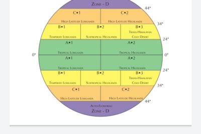
Srinagar city floor has an elevation of approximately 1585 meters or 5200 ft. and it is located at 34.5’24 N and 74.47’24 E of the equator putting it right above the other 2 Himalayan states latitude wise Himachal Pradesh and Uttarakhand spans below 33 N at any given part.
Kashmir terrains are distinctly different from that of Himachal Pradesh or Uttrakhand, instead of narrow valleys and mountain slopes the capital city Srinagar is nestled on an absolutely enormous flat land valley surrounded by high mountain ranges and silhouettes of snowy peaks behind them which can be seen at the horizon at all times no matter where go in the city. In the seemingly modern outdoors it serves as a constant reminder that you’re deep in the laps of the great Himalayan ranges.
The climate can be classified as Humid/Subtropical under the Koppen-Geiger system but in order to account for the considerable variation in the range of altitudes between the valley and the surrounding mountains we can more accurately classify it as temperature to Mediterranean type of climate. the difference between the highest point in Srinagar and the city floor is more than 10,000 ft. and it creates wide variation in the climate experienced at various places in Srinagar. The temperatures can plummet to the lowest of -15-20 C at the peak of winters between 15th Jan to 15th Feb. which also marks the period of heavy snowfall. snowfall is light to mild around the main city area where conditions are a bit more tropical and humid and heavier towards the mountains and outskirts at higher altitudes with a much colder and drier atmosphere.
Srinagar gets around 700 mm rainfall which is concentrated majorly within the spring season and at least 60% of total precipitation comes in the form of snow during winters. Autumn and winter seasons are quite cold and dry with occasional rains that feel much similar to a high latitude region such as Afghanistan or northern Pakistan. Daytime temperatures averages around 2-3 C with subzero nights and the period of March to June marks the summer season in the valley wherein daytime temperatures can average around 25 C with highs of 35+ C and
an average RH of around 60% in the city area adding to the short-lived tropical experience. the district, in general, shows conspicuous physiographic variations, consisting mainly of – moderately high hills, mountain ranges, and alluvial tracts. 50% of the area of Srinagar is covered by high hills characterized hilly rugged and undulating topography. the lower altitudes consists of alluvial tracts which cover the Srinagar city area and all the non-hilly parts around it. the district is bounded by the Himalayas from south east, north, and north west. Jhelum river in the south which extends up to the western territories.
1. Hapludalfs
This soils is found on the karewa table tops with a slope variation of 1-3% , the soil is well drained with moderate
to average permeability. this type of soil is prone to severe erosion and forming gullies and ravines.
these are medium to fine textured soils nd the surface texture varies from clay-loam to silty clay loam. the color
of the soil varies from yellowish brown to dark brown and it’s mostly used for cultivating wheat, maize and pulses.
2. Ochraqualfs
these soils are found in plain (flat land) to mid upland topography, these soils are moderately textured with fine
clay loam as the predominant surface texture. the extent of erosion on such soils is much less, it can be from
dark brown to dark yellowish-brown in color. These soils are less permeable as a result of being finer and packed
densely and it’s mainly used for the cultivation of rice and spices like mustard.
.
- Srinagar Outskirts (upland and alluvial tracts 1500-2000 meters)
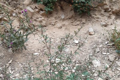
Srinagar Outskirts consists of wet grassy swamps, alluvial tracts, and mild uplands featuring (type 2 Ochraqualfs
soil).
Srinagar outskirts have a balanced mix of tree growth and open grassy lands but not dense jungles, bonafide
forests only begin from the lower to mid-mountain range. real-time feel during the October is very dry and cold
especially during the night time. very dry glacial winds blow down towards the valley penetrating through the
outskirts first, which adds to the gradually increasing cold during this period.
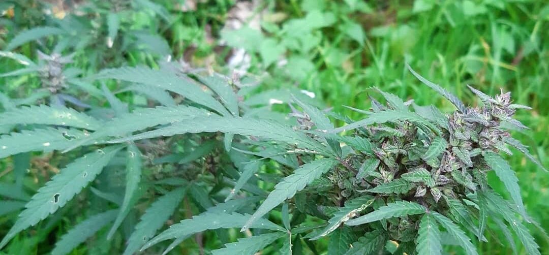
There is no farmed or cultivated cannabis in Srinagar, even towards the outskirts all of the cannabis grows in a
regenerative manner every year and without any maintenance. however, local people take full advantage of this
opportunity during September and October by making hand-rubbed charas and also dry sifting the remainder in
the late season to make signature corn husk wrapped hashish.
DETAILS AT A GLANCE
Site Altitude : 1900 meters
Avg. population height : 5-6ft
stature : short to medium tall
leaf type : normal on medium tall plants and roundish leaves on short plants
stem color : red and green both (less red)
anthocyanin production : yes in the majority of the plants
smell : sweet/grape /slightly diesel and sour
taste : grape sweet and incense
effects : cerebral with gradually increasing onset
trichome quality : sticky normal (not very sticky like highland varieties)
life span : april to october (12 week flowering maximum)
bud structure : airy, fluffy tightly held small bract production covered in extremely dense resin coating.


- Srinagar Town (flatland and alluvial tracts 1500-1700 meters)
Srinagar inside city features a lot of buildings, housing, markets, busy streets, and roadways, but with a closer look at the inner city
most of it is still developing and a lot of ongoing construction can be seen at places where small yet complex ecosystems exist.
cannabis plants can be literally seen growing everywhere throughout the city, the roadsides run parallel with either marshy or wet
lands or small canals drawn from the Jhelum river that flows right through the city.
There is no farmed or cultivated cannabis in Srinagar city, however, local people take full advantage of this opportunity during
September and October by making hand-rubbed charas and also dry sifting the remainder in late season to make signature corn
husk wrapped hashish.
DETAILS AT A GLANCE
Site Altitude: 1700
Avg. population height: 7-8ft (majority of the plants express a taller expression)
stature: short to medium tall
leaf type: normal on medium-tall plants and roundish leaves on short plants
stem color: red and green both (less red)
anthocyanin production: yes in the majority of the plants
smell: sweet/grape /slightly diesel-like and sour
taste: grape sweet, diesel
effects: cerebral with gradually increasing onset
trichome quality: sticky normal (not very sticky like highland varieties)
life span : April to October (12 weeks flowering maximum)
bud structure: airy, fluffy tightly held small bract production covered in an extremely dense resin coating


- Dachigam National Park (high-mountain 2500-3000+ meters)
This is a protected area so there is minimal to no housing or regular human activities in this area .
The only people who do make it to this part are goat herders based on the goat droppings on the grassy patches and missing tops of
cannabis plants. This particular spot is approximately 3100 meters in altitude at around 34°N , which makes it very interesting in many
ways. It’s a High latitude region with a considerable altitude, thus the season is really short and snow starts to set in from November first
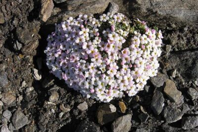
week. Open grazing spots like this on the mountain tops doesn’t appear to have any cannabis populations at all but when we bent down
and took a closer look we found the small trodden plants growing everywhere on the floor amid the grass and other wild plants but that
is only one half of the story or say tip of the iceberg there is another population growing beside these tiny plants which are medium tall
in height and coated in thick resin layers from bracts to leaf and petioles.


Site Altitude:2500+ meters
Avg. population height: 4-6 ft (majority of the plants express a smaller expression)
stature: short to medium tall
leaf type: normal on medium-tall plants and roundish leaves on short plants
stem color: red and green both (less red)
anthocyanin production: yes in the majority of the plants
smell: sweet/grape /slightly diesel-like and sour
taste: grape sweet, diesel
effects : cerebral with gradually increasing onset
trichome quality: extremely sticky
life span: May to October (10 weeks flowering maximum)
bud structure: airy, fluffy tightly held small bract production covered in an extremely dense resin coating.
